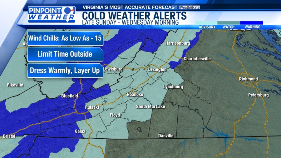
ROANOKE, Va. (WFXR) — An Extreme Cold Warning is in effect for parts of the Highlands and New River Valley with a Cold Weather Advisory east to the Blue Ridge.

When factoring in the wind, it will feel like it is below zero overnight into the day on Monday.

Winds will gusts to near 30 mph throughout the day, decreasing Monday night into Tuesday morning. Winds will be much lighter on Tuesday.

Air temperatures will remain below freezing on Monday, starting the day in the single digits and teens. During the afternoon, high temperatures will rise into the teens and 20s for most of the region.


Snow is also expected to continue for the western mountains. Another one to four inches is possible. Winter Storm Warnings and Winter Weather Advisories will continue into Monday morning.

As the snow showers exit, sunshine is expected to return to start the new work week.
Temperatures will remain well below average through Wednesday with lows in the single digits and teens and highs in the 20s. Temperatures return to the 30s on Thursday and 40s for Friday and the weekend.

