ROANOKE, Va. (WFXR) — Bitterly cold conditions will impact Southwest and Central Virginia for the middle of the week.

Tuesday will be blustery and colder with mostly to partly sunny skies overhead. Wind gusts of 25 – 35 mph may occur. Morning temperatures will start in the teens and lower 20s, with wind chill values below zero west of the Blue Ridge. Afternoon highs will be in the 30s and lower 40s.

Mountain snow showers are possible to the west. Overall, snowfall should remain light. One to two inches of snow is possible in western Highland, Greenbrier, and Pocahontas counties.


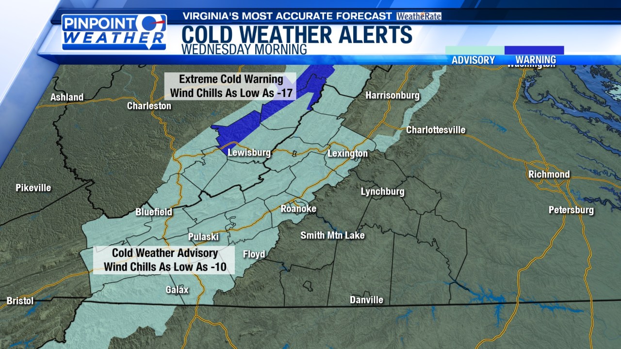
Wednesday will be the coldest day of the week. Morning lows will be in the single digits and teens. However, blustery winds will result in below-zero wind chills along and west of the Blue Ridge. Despite the mostly sunny skies overhead, afternoon temperatures will rise into the 20s and 30s.


A warming trend is anticipated for the end of the week as cold air advection weakens. For Thursday, morning temperatures will start in the teens while afternoon temperatures will warm up into the 30s and lower 40s. A clipper system will bring mountain snow showers to areas north of I-64, but much of the region will stay mostly dry.
Near-average temperatures are anticipated on Friday. The morning will start with temperatures in the 20s and lower 30s. Highs will be in the 40s. Clouds will gradually increase later in the day.

A weekend storm system will bring mainly rain showers to Southwest and Central Virginia. Cold air will return by the beginning of next week.