ROANOKE, Va. (WFXR) — Well below-average temperatures and bitterly cold wind chills will continue to impact Southeast and Central Virginia through the end of the week.

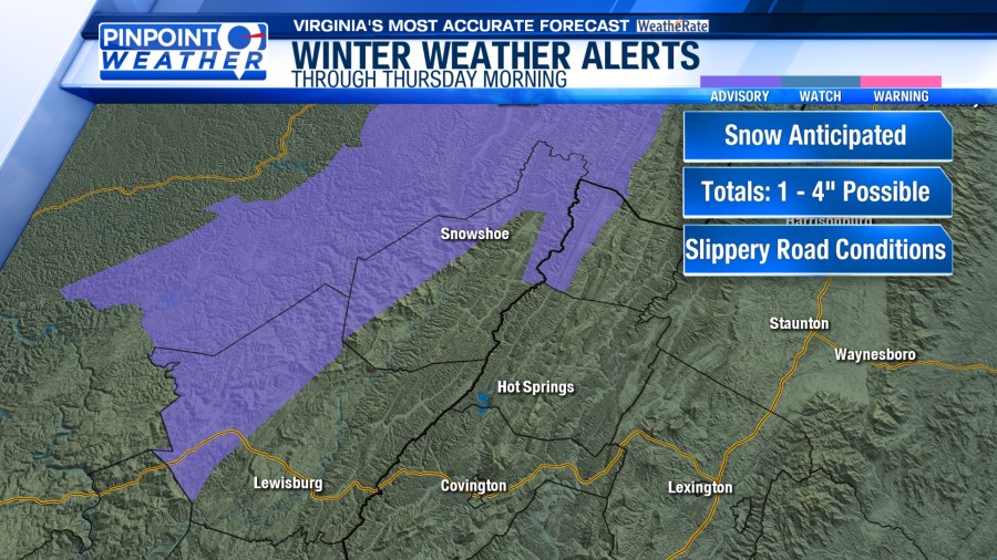
A Winter Weather Advisory has been issued for portions of Greenbrier, Highland, and Pocahontas Counties through Thursday morning. Occasional snow showers could bring one to four inches to the western slopes.


Snow flurries are possible west of the Blue Ridge, but much of Southwest and Central Virginia will stay mostly dry on Wednesday. A mix of sun and clouds will be overhead. Morning lows will be in the teens while afternoon temperatures will rise into the 20s and lower 30s. Breezy winds will result in bitterly cold wind chills ranging from the teens to below zero.

Blustery winds and frigid temperatures are slated for Thursday. Morning temperatures will start in the single digits and teens with wind chills in the single digits and below zero. Despite the additional sunshine, highs will be in the 20s and lower 30s.

A low-pressure system tracking out of the Gulf of Mexico will bring moisture to Southwest and Central Virginia Friday afternoon into Saturday. Plentiful cold air will allow snow to develop. However, the timing/track of this system and the amount of dry air in place will impact snowfall amounts and precipitation types.

This isn’t expected to be a big snowstorm, but accumulating snowfall will probably occur. The WFXR Pinpoint Weather Team will continue to monitor the situation.