ROANOKE, Va. (WFXR) — Near-average temperatures will return to Southwest and Central Virginia on Monday. Gusty winds and slightly warmer conditions are anticipated for the middle of the week.
On Monday, light morning rain and snow showers are possible south of U.S. 460. Otherwise, decreasing cloudiness is expected for the day. Afternoon highs will be in the near-average 40s and lower 50s.

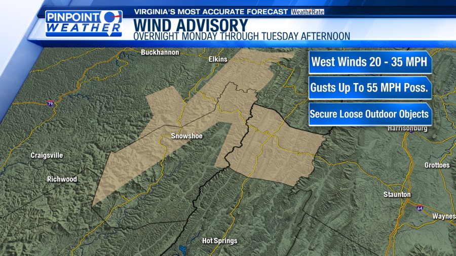
More sunshine is slated for Tuesday, but winds will be blustery. Expect gusts as high as 20 – 40 mph. Wind Advisories will be in effect for Highland and northwestern Pocahontas counties through Tuesday afternoon. West winds of 20 – 35 mph are expected with gusts as high as 55 mph possible. Downed trees and power outages may occur.


Tuesday’s temperatures will be slightly warmer. Morning lows will be in the upper 20s and lower 30s. Afternoon highs will top out in the 40s and 50s.
While winds will subside for Tuesday night, windy conditions will return on Wednesday. Due to warm southwesterly flow, temperatures will rise into the 50s and lower 60s under mostly sunny skies.


Wind speeds will decrease on Thursday as high pressure passes overhead. Highs will be in the 40s and lower 50s. Clouds will increase late in the day as a weather system approaches from the west.

A warm front will bring scattered rain showers to Southwest and Central Virginia on Friday and Saturday. This will mainly be a rain event since temperatures will likely be well above freezing. The wet weather may linger into Sunday morning before tapering off around midday.