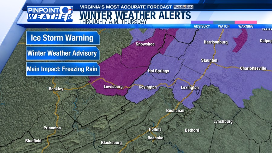
ROANOKE, Va. (WFXR) — An Ice Storm Warning continues for Greenbrier, western Highland and Pocahontas Counties through 7 a.m. Thursday with Winter Weather Advisory for Alleghany, Bath, eastern Highland and Rockbridge Counties.

The heaviest icing will be north of Interstate 64 and at the higher elevations. Lighter amounts of ice will occur in the valleys. A glaze is possible further south for the higher elevations along the Blue Ridge.

Temperatures will hold steady or slowly rise during the early morning hours on Thursday, which should allow freezing rain to switch to cold rain. Temperatures will continue to rise well above freezing on Thursday, with afternoon highs in the 50s.


Areas of rain are most likely overnight and into Thursday morning. Showers will be more spotty during the afternoon with some areas seeing a little sunshine.
Heavy rain is possible for the northwestern mountains, where one to two inches is expected. A Flood Watch is in effect through midday for Pocahontas County.


Temperatures will remain warm on Friday. Showers return to the region on Saturday, with highs only in the 40s. Many areas dry out on Sunday with highs in the 50s. We will have to watch the first-half of next week as rain and snow are possible. Temperatures will top out near 40.

