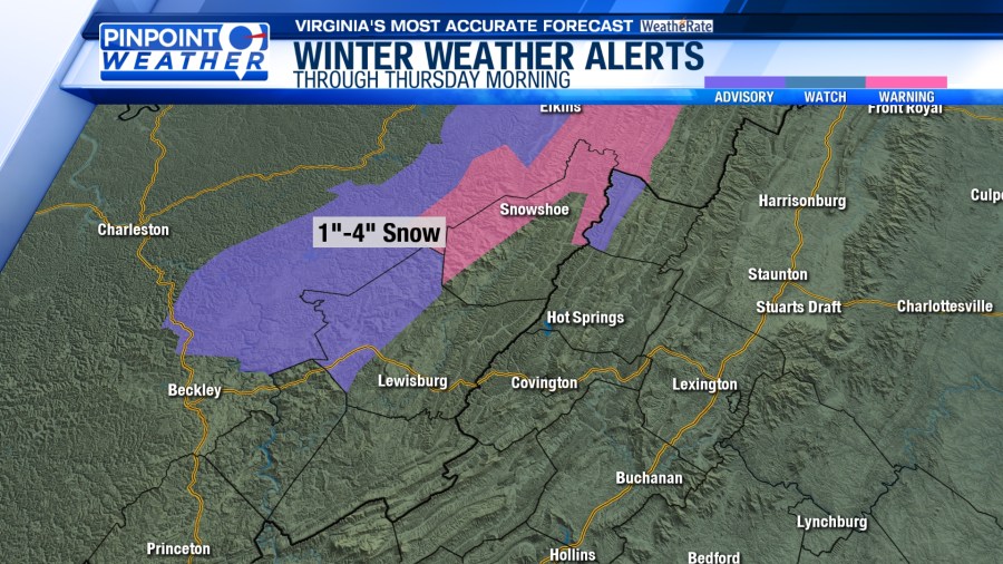
ROANOKE, Va. (WFXR) — A Winter Weather Advisory and Winter Storm Warning remains in effect for parts of the Highlands with one to four total inches of snow expected through Thursday morning.

A Cold Weather Advisory is in effect through noon on Thursday. It will feel like -15 to -5 because of the wind.

Wind speeds will increase overnight into Thursday morning with gusts to 30 mph possible. Wind speeds will decrease Thursday night into Friday.

The next storm system will impact the region Friday afternoon through Saturday morning. Due to the cold air in place, this will mainly bring snow. Areas near Interstate 64 will see the least with 1-2 inches expected. Most of the region looks to pick up 2-4 inches with the western mountains seeing 4-7 inches.

Until that storm arrives, sunshine will return for Thursday, but the cold air will remain in place.
Temperatures will start the day in the teens, rising into the 20s and 30s for the afternoon.


Temperatures will begin to rebound after the snow moves out, rising into the 30s through the weekend. Temperatures will top out in the lower 40s on Monday before returning to the 30s starting on Tuesday.

